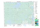
Maps showing Saint-Christophe, Rouyn-Noranda; Rouyn-Noranda, Quebec
Saint-Christophe is a Geographical area located in Rouyn-Noranda; Rouyn-Noranda, Quebec.
- Latitude: 48° 22' North (decimal: 48.3666999)
- Longitude: 79° 1' West (decimal: -79.0167000)
- Topography Feature Category: Geographical area
- Geographical Feature: Paroisse
- Canadian Province/Territory: Quebec
- Location: Rouyn-Noranda; Rouyn-Noranda
- Atlas of Canada Locator Map: Saint-Christophe
- GPS Coordinate Locator Map: Saint-Christophe Lat/Long
Saint-Christophe NTS Map Sheets