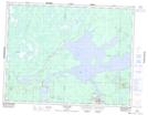
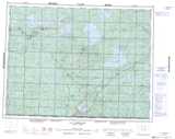
Maps showing Le Sacré-Coeur, Matagami; Jamésie, Quebec
Le Sacré-Coeur is a Geographical area located in Matagami; Jamésie, Quebec.
- Latitude: 49° 45' 25'' North (decimal: 49.7569444)
- Longitude: 77° 37' 21'' West (decimal: -77.6225)
- Topography Feature Category: Geographical area
- Geographical Feature: Paroisse
- Canadian Province/Territory: Quebec
- Location: Matagami; Jamésie
- Atlas of Canada Locator Map: Le Sacré-Coeur
- GPS Coordinate Locator Map: Le Sacré-Coeur Lat/Long
Le Sacré-Coeur NTS Map Sheets