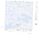
Maps showing Havre Thompson, Baie-d'Hudson; Kativik, Quebec
Havre Thompson is a Bay located in Baie-d'Hudson; Kativik, Quebec and has an elevation of 0 meters.
- Latitude: 60° 13' 30'' North (decimal: 60.2249866)
- Longitude: 77° 33' 19'' West (decimal: -77.5554152)
- Topography Feature Category: Bay
- Geographical Feature: Havre
- Canadian Province/Territory: Quebec
- Elevation: 0 meters
- Location: Baie-d'Hudson; Kativik
- Atlas of Canada Locator Map: Havre Thompson
- GPS Coordinate Locator Map: Havre Thompson Lat/Long
Havre Thompson NTS Map Sheets