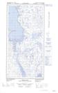
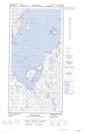
Maps showing Anse Heel, Rivière-Koksoak; Kativik, Quebec
Anse Heel is a Bay located in Rivière-Koksoak; Kativik, Quebec and has an elevation of 0 meters.
- Latitude: 60° 48' 28'' North (decimal: 60.8077169)
- Longitude: 69° 53' 44'' West (decimal: -69.8954320)
- Topography Feature Category: Bay
- Geographical Feature: Anse
- Canadian Province/Territory: Quebec
- Elevation: 0 meters
- Location: Rivière-Koksoak; Kativik
- Atlas of Canada Locator Map: Anse Heel
- GPS Coordinate Locator Map: Anse Heel Lat/Long
Anse Heel NTS Map Sheets