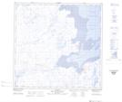
Maps showing Anse Funnel, Rivière-Koksoak; Kativik, Quebec
Anse Funnel is a Bay located in Rivière-Koksoak; Kativik, Quebec and has an elevation of 1 meters.
- Latitude: 59° 18' 20'' North (decimal: 59.3054831)
- Longitude: 69° 37' 25'' West (decimal: -69.6237081)
- Topography Feature Category: Bay
- Geographical Feature: Baie
- Canadian Province/Territory: Quebec
- Elevation: 1 meters
- Location: Rivière-Koksoak; Kativik
- Atlas of Canada Locator Map: Anse Funnel
- GPS Coordinate Locator Map: Anse Funnel Lat/Long
Anse Funnel NTS Map Sheets