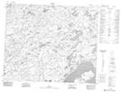
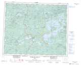
Maps showing Ruisseau Umatahastikw, Baie-James; Jamésie, Quebec
Ruisseau Umatahastikw is a River located in Baie-James; Jamésie, Quebec.
- Latitude: 52° 56' 48'' North (decimal: 52.9466667)
- Longitude: 77° 59' 48'' West (decimal: -77.9966667)
- Topography Feature Category: River
- Geographical Feature: Ruisseau
- Canadian Province/Territory: Quebec
- Location: Baie-James; Jamésie
- Atlas of Canada Locator Map: Ruisseau Umatahastikw
- GPS Coordinate Locator Map: Ruisseau Umatahastikw Lat/Long