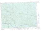
Maps showing Le Duck Pond, Rivière-Kipawa; Témiscamingue, Quebec
Le Duck Pond is a Lake located in Rivière-Kipawa; Témiscamingue, Quebec.
- Latitude: 46° 22' 35'' North (decimal: 46.3764474)
- Longitude: 78° 13' 41'' West (decimal: -78.2281006)
- Topography Feature Category: Lake
- Geographical Feature: Lac
- Canadian Province/Territory: Quebec
- Location: Rivière-Kipawa; Témiscamingue
- Atlas of Canada Locator Map: Le Duck Pond
- GPS Coordinate Locator Map: Le Duck Pond Lat/Long
Le Duck Pond NTS Map Sheets