Maps showing Lac Smith, Rivière-aux-Outardes; Manicouagan, Quebec
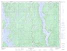
Lac Smith is a Lake located in Rivière-aux-Outardes; Manicouagan, Quebec.
- Latitude: 49° 54' 42'' North (decimal: 49.9117203)
- Longitude: 68° 31' 58'' West (decimal: -68.5328082)
- Topography Feature Category: Lake
- Geographical Feature: Lac
- Canadian Province/Territory: Quebec
- Location: Rivière-aux-Outardes; Manicouagan
- Atlas of Canada Locator Map: Lac Smith
- GPS Coordinate Locator Map: Lac Smith Lat/Long
Lac Smith NTS Map Sheets