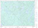
Maps showing Lac Plat, Lac-Bazinet; Antoine-Labelle, Quebec
Lac Plat is a Lake located in Lac-Bazinet; Antoine-Labelle, Quebec.
- Latitude: 47° 22' 56'' North (decimal: 47.3822858)
- Longitude: 74° 42' 21'' West (decimal: -74.7057118)
- Topography Feature Category: Lake
- Geographical Feature: Lac
- Canadian Province/Territory: Quebec
- Location: Lac-Bazinet; Antoine-Labelle
- GPS Coordinate Locator Map: Lac Plat Lat/Long
Lac Plat NTS Map Sheets