Maps showing Île Kâmicikamak, Baie-James; Jamésie, Quebec
Île Kâmicikamak is a Island located in Baie-James; Jamésie, Quebec and has an elevation of 282 meters.
- Latitude: 49° 3' 53'' North (decimal: 49.0647222)
- Longitude: 76° 52' 59'' West (decimal: -76.8830556)
- Topography Feature Category: Island
- Geographical Feature: Île / Ile
- Canadian Province/Territory: Quebec
- Elevation: 282 meters
- Location: Baie-James; Jamésie
- Atlas of Canada Locator Map: Île Kâmicikamak
- GPS Coordinate Locator Map: Île Kâmicikamak Lat/Long
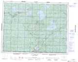
Île Kâmicikamak NTS Map Sheets