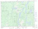
Maps showing Île du Lac Rocher, Rémigny; Témiscamingue, Quebec
Île du Lac Rocher is a Island located in Rémigny; Témiscamingue, Quebec.
- Latitude: 47° 48' 45'' North (decimal: 47.8125)
- Longitude: 79° 7' 32'' West (decimal: -79.1255556)
- Topography Feature Category: Island
- Geographical Feature: Île / Ile
- Canadian Province/Territory: Quebec
- Location: Rémigny; Témiscamingue
- Atlas of Canada Locator Map: Île du Lac Rocher
- GPS Coordinate Locator Map: Île du Lac Rocher Lat/Long
Île du Lac Rocher NTS Map Sheets