Maps showing Le Reef, Laforce; Témiscamingue, Quebec
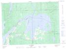
Le Reef is a Shoal located in Laforce; Témiscamingue, Quebec.
- Latitude: 47° 38' 50'' North (decimal: 47.6472222)
- Longitude: 78° 44' 1'' West (decimal: -78.7336111)
- Topography Feature Category: Shoal
- Geographical Feature: Haut-fond
- Canadian Province/Territory: Quebec
- Location: Laforce; Témiscamingue
- Atlas of Canada Locator Map: Le Reef
- GPS Coordinate Locator Map: Le Reef Lat/Long
Le Reef NTS Map Sheets