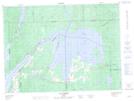
Maps showing Île Peter, Moffet; Témiscamingue, Quebec
Île Peter is a Island located in Moffet; Témiscamingue, Quebec.
- Latitude: 47° 36' 36'' North (decimal: 47.61)
- Longitude: 78° 46' 58'' West (decimal: -78.7827778)
- Topography Feature Category: Island
- Geographical Feature: Île / Ile
- Canadian Province/Territory: Quebec
- Location: Moffet; Témiscamingue
- Atlas of Canada Locator Map: Île Peter
- GPS Coordinate Locator Map: Île Peter Lat/Long
Île Peter NTS Map Sheets