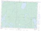
Maps showing Pointe de la C.I.P., Rivière-Kipawa; Témiscamingue, Quebec
Pointe de la C.I.P. is a Cape located in Rivière-Kipawa; Témiscamingue, Quebec.
- Latitude: 47° 50' 12'' North (decimal: 47.8366667)
- Longitude: 77° 59' 44'' West (decimal: -77.9955556)
- Topography Feature Category: Cape
- Geographical Feature: Pointe
- Canadian Province/Territory: Quebec
- Location: Rivière-Kipawa; Témiscamingue
- Atlas of Canada Locator Map: Pointe de la C.I.P.
- GPS Coordinate Locator Map: Pointe de la C.I.P. Lat/Long
Pointe de la C.I.P. NTS Map Sheets