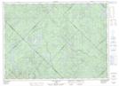
Maps showing Lac Gilles, Lac-Matawin; Matawinie, Quebec
Lac Gilles is a Lake located in Lac-Matawin; Matawinie, Quebec.
- Latitude: 46° 54' 38'' North (decimal: 46.9105556)
- Longitude: 74° 14' 22'' West (decimal: -74.2394443)
- Topography Feature Category: Lake
- Geographical Feature: Lac
- Canadian Province/Territory: Quebec
- Location: Lac-Matawin; Matawinie
- Atlas of Canada Locator Map: Lac Gilles
- GPS Coordinate Locator Map: Lac Gilles Lat/Long
Lac Gilles NTS Map Sheets