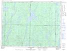
Maps showing Wewedinagamik, Senneterre; Vallée-de-l'Or, Quebec
Wewedinagamik is a River located in Senneterre; Vallée-de-l'Or, Quebec and has an elevation of 382 meters.
- Latitude: 48° 57' 58'' North (decimal: 48.9661111)
- Longitude: 76° 12' 45'' West (decimal: -76.2125)
- Topography Feature Category: River
- Geographical Feature: Segment de rivière
- Canadian Province/Territory: Quebec
- Elevation: 382 meters
- Location: Senneterre; Vallée-de-l'Or
- Atlas of Canada Locator Map: Wewedinagamik
- GPS Coordinate Locator Map: Wewedinagamik Lat/Long
Wewedinagamik NTS Map Sheets