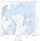
Maps showing Lacs Tunnuujaliit, Rivière-Koksoak; Kativik, Quebec
Lacs Tunnuujaliit is a Lake located in Rivière-Koksoak; Kativik, Quebec.
- Latitude: 59° 5' 46'' North (decimal: 59.0960188)
- Longitude: 69° 11' 11'' West (decimal: -69.1864829)
- Topography Feature Category: Lake
- Geographical Feature: Lacs
- Canadian Province/Territory: Quebec
- Location: Rivière-Koksoak; Kativik
- Atlas of Canada Locator Map: Lacs Tunnuujaliit
- GPS Coordinate Locator Map: Lacs Tunnuujaliit Lat/Long
Lacs Tunnuujaliit NTS Map Sheets