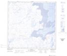
Maps showing Pointe Utarqiuvik, Rivière-Koksoak; Kativik, Quebec
Pointe Utarqiuvik is a Cape located in Rivière-Koksoak; Kativik, Quebec and has an elevation of 1 meters.
- Latitude: 59° 29' 14'' North (decimal: 59.4871524)
- Longitude: 69° 42' 45'' West (decimal: -69.7125927)
- Topography Feature Category: Cape
- Geographical Feature: Pointe
- Canadian Province/Territory: Quebec
- Elevation: 1 meters
- Location: Rivière-Koksoak; Kativik
- Atlas of Canada Locator Map: Pointe Utarqiuvik
- GPS Coordinate Locator Map: Pointe Utarqiuvik Lat/Long
Pointe Utarqiuvik NTS Map Sheets