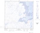
Maps showing Aananniavik, Rivière-Koksoak; Kativik, Quebec
Aananniavik is a River located in Rivière-Koksoak; Kativik, Quebec and has an elevation of 38 meters.
- Latitude: 59° 17' 57'' North (decimal: 59.2990952)
- Longitude: 69° 49' 45'' West (decimal: -69.8292694)
- Topography Feature Category: River
- Geographical Feature: Segment de rivière
- Canadian Province/Territory: Quebec
- Elevation: 38 meters
- Location: Rivière-Koksoak; Kativik
- Atlas of Canada Locator Map: Aananniavik
- GPS Coordinate Locator Map: Aananniavik Lat/Long
Aananniavik NTS Map Sheets