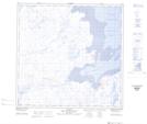
Maps showing Îles Nunagirnigaq, Rivière-Koksoak; Kativik, Quebec
Îles Nunagirnigaq is a Island located in Rivière-Koksoak; Kativik, Quebec.
- Latitude: 59° 22' 52'' North (decimal: 59.3810396)
- Longitude: 69° 32' 47'' West (decimal: -69.5464811)
- Topography Feature Category: Island
- Geographical Feature: Îles / Iles
- Canadian Province/Territory: Quebec
- Location: Rivière-Koksoak; Kativik
- Atlas of Canada Locator Map: Îles Nunagirnigaq
- GPS Coordinate Locator Map: Îles Nunagirnigaq Lat/Long
Îles Nunagirnigaq NTS Map Sheets