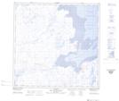
Maps showing Colline Saputiit, Aupaluk; Kativik, Quebec
Colline Saputiit is a Mountain located in Aupaluk; Kativik, Quebec and has an elevation of 57 meters.
- Latitude: 59° 17' 41'' North (decimal: 59.2946493)
- Longitude: 69° 35' 10'' West (decimal: -69.5862079)
- Topography Feature Category: Mountain
- Geographical Feature: Colline
- Canadian Province/Territory: Quebec
- Elevation: 57 meters
- Location: Aupaluk; Kativik
- Atlas of Canada Locator Map: Colline Saputiit
- GPS Coordinate Locator Map: Colline Saputiit Lat/Long
Colline Saputiit NTS Map Sheets