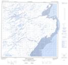
Maps showing Itigaijarviup Kuunga, Rivière-Koksoak; Kativik, Quebec
Itigaijarviup Kuunga is a River located in Rivière-Koksoak; Kativik, Quebec.
- Latitude: 59° 35' 41'' North (decimal: 59.5946547)
- Longitude: 69° 54' 14'' West (decimal: -69.9039847)
- Topography Feature Category: River
- Geographical Feature: Segment de rivière
- Canadian Province/Territory: Quebec
- Location: Rivière-Koksoak; Kativik
- Atlas of Canada Locator Map: Itigaijarviup Kuunga
- GPS Coordinate Locator Map: Itigaijarviup Kuunga Lat/Long
Itigaijarviup Kuunga NTS Map Sheets