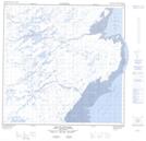
Maps showing Côte Qarmait, Rivière-Koksoak; Kativik, Quebec
Côte Qarmait is a Cape located in Rivière-Koksoak; Kativik, Quebec.
- Latitude: 59° 38' 51'' North (decimal: 59.6474286)
- Longitude: 69° 30' 30'' West (decimal: -69.5084118)
- Topography Feature Category: Cape
- Geographical Feature: Côte
- Canadian Province/Territory: Quebec
- Location: Rivière-Koksoak; Kativik
- Atlas of Canada Locator Map: Côte Qarmait
- GPS Coordinate Locator Map: Côte Qarmait Lat/Long
Côte Qarmait NTS Map Sheets