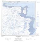
Maps showing Pointe Qainnguluttuq, Rivière-Koksoak; Kativik, Quebec
Pointe Qainnguluttuq is a Cape located in Rivière-Koksoak; Kativik, Quebec.
- Latitude: 59° 57' 43'' North (decimal: 59.9618780)
- Longitude: 69° 50' 57'' West (decimal: -69.8492324)
- Topography Feature Category: Cape
- Geographical Feature: Pointe
- Canadian Province/Territory: Quebec
- Location: Rivière-Koksoak; Kativik
- Atlas of Canada Locator Map: Pointe Qainnguluttuq
- GPS Coordinate Locator Map: Pointe Qainnguluttuq Lat/Long
Pointe Qainnguluttuq NTS Map Sheets