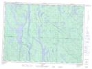
Maps showing Étang Diane, Lac-Nilgaut; Pontiac, Quebec
Étang Diane is a Low vegetation located in Lac-Nilgaut; Pontiac, Quebec.
- Latitude: 46° 51' 30'' North (decimal: 46.8583911)
- Longitude: 77° 44' 49'' West (decimal: -77.7469692)
- Topography Feature Category: Low vegetation
- Geographical Feature: Marécage
- Canadian Province/Territory: Quebec
- Location: Lac-Nilgaut; Pontiac
- Atlas of Canada Locator Map: Étang Diane
- GPS Coordinate Locator Map: Étang Diane Lat/Long
Étang Diane NTS Map Sheets