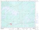
Maps showing Mine Perry, Chapais; Jamésie, Quebec
Mine Perry is a Natural resources site located in Chapais; Jamésie, Quebec.
- Latitude: 49° 47' 22'' North (decimal: 49.7894444)
- Longitude: 74° 51' 47'' West (decimal: -74.8630555)
- Topography Feature Category: Natural resources site
- Geographical Feature: Mine
- Canadian Province/Territory: Quebec
- Location: Chapais; Jamésie
- Atlas of Canada Locator Map: Mine Perry
- GPS Coordinate Locator Map: Mine Perry Lat/Long
Mine Perry NTS Map Sheets