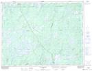
Maps showing Baies Nemenjiche, Baie-James; Jamésie, Quebec
Baies Nemenjiche is a Bay located in Baie-James; Jamésie, Quebec and has an elevation of 380 meters.
- Latitude: 49° 33' 9'' North (decimal: 49.5525683)
- Longitude: 74° 26' 25'' West (decimal: -74.4404129)
- Topography Feature Category: Bay
- Geographical Feature: Baies
- Canadian Province/Territory: Quebec
- Elevation: 380 meters
- Location: Baie-James; Jamésie
- Atlas of Canada Locator Map: Baies Nemenjiche
- GPS Coordinate Locator Map: Baies Nemenjiche Lat/Long
Baies Nemenjiche NTS Map Sheets