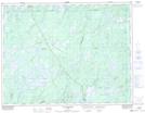
Maps showing Première baie des Lacs Obatogamau, Baie-James; Jamésie, Quebec
Première baie des Lacs Obatogamau is a Bay located in Baie-James; Jamésie, Quebec and has an elevation of 382 meters.
- Latitude: 49° 32' 12'' North (decimal: 49.5366667)
- Longitude: 74° 22' 37'' West (decimal: -74.3769444)
- Topography Feature Category: Bay
- Geographical Feature: Baie
- Canadian Province/Territory: Quebec
- Elevation: 382 meters
- Location: Baie-James; Jamésie
- Atlas of Canada Locator Map: Première baie des Lacs Obatogamau
- GPS Coordinate Locator Map: Première baie des Lacs Obatogamau Lat/Long
Première baie des Lacs Obatogamau NTS Map Sheets