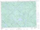
Maps showing Étang Beaudet, Lac-Normand; Mékinac, Quebec
Étang Beaudet is a Lake located in Lac-Normand; Mékinac, Quebec.
- Latitude: 47° 13' 23'' North (decimal: 47.2230556)
- Longitude: 73° 28' 43'' West (decimal: -73.4786111)
- Topography Feature Category: Lake
- Geographical Feature: Étang
- Canadian Province/Territory: Quebec
- Location: Lac-Normand; Mékinac
- Atlas of Canada Locator Map: Étang Beaudet
- GPS Coordinate Locator Map: Étang Beaudet Lat/Long
Étang Beaudet NTS Map Sheets