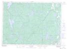
Maps showing Outaouais, Lac-Pythonga; La Vallée-de-la-Gatineau, Quebec
Outaouais is a Major municipal/district area - major agglomeration located in Lac-Pythonga; La Vallée-de-la-Gatineau, Quebec.
- Latitude: 46° 16' North (decimal: 46.2666666)
- Longitude: 76° 19' West (decimal: -76.3166666)
- Topography Feature Category: Major municipal/district area - major agglomeration
- Geographical Feature: Région administrative
- Canadian Province/Territory: Quebec
- Location: Lac-Pythonga; La Vallée-de-la-Gatineau
- Atlas of Canada Locator Map: Outaouais
- GPS Coordinate Locator Map: Outaouais Lat/Long
Outaouais NTS Map Sheets