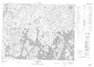
Maps showing Rivière à l'Épinette, Mont-Valin; Le Fjord-du-Saguenay, Quebec
Rivière à l'Épinette is a River located in Mont-Valin; Le Fjord-du-Saguenay, Quebec.
- Latitude: 49° 38' 0'' North (decimal: 49.6333764)
- Longitude: 70° 44' 23'' West (decimal: -70.7397981)
- Topography Feature Category: River
- Geographical Feature: Rivière
- Canadian Province/Territory: Quebec
- Location: Mont-Valin; Le Fjord-du-Saguenay
- GPS Coordinate Locator Map: Rivière à l'Épinette Lat/Long
Rivière à l'Épinette NTS Map Sheets