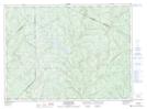
Maps showing Les Fourches, Lejeune; Témiscouata, Quebec
Les Fourches is a River feature located in Lejeune; Témiscouata, Quebec and has an elevation of 255 meters.
- Latitude: 47° 41' 9'' North (decimal: 47.6858333)
- Longitude: 68° 29' 17'' West (decimal: -68.4880555)
- Topography Feature Category: River feature
- Geographical Feature: Confluent
- Canadian Province/Territory: Quebec
- Elevation: 255 meters
- Location: Lejeune; Témiscouata
- Atlas of Canada Locator Map: Les Fourches
- GPS Coordinate Locator Map: Les Fourches Lat/Long
Les Fourches NTS Map Sheets