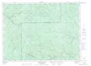
Maps showing Lac Julie, Biencourt; Témiscouata, Quebec
Lac Julie is a Lake located in Biencourt; Témiscouata, Quebec and has an elevation of 294 meters.
- Latitude: 47° 51' 37'' North (decimal: 47.8603115)
- Longitude: 68° 28' 44'' West (decimal: -68.4789101)
- Topography Feature Category: Lake
- Geographical Feature: Lac artificiel
- Canadian Province/Territory: Quebec
- Elevation: 294 meters
- Location: Biencourt; Témiscouata
- Atlas of Canada Locator Map: Lac Julie
- GPS Coordinate Locator Map: Lac Julie Lat/Long
Lac Julie NTS Map Sheets