Canada Topographic Maps

Zec de la Rivière-Blanche Topo Maps

Topography maps and Latitude/Longitude Location

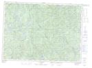
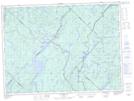
Maps showing Zec de la Rivière-Blanche, Lac-Blanc; Portneuf, Quebec

Zec de la Rivière-Blanche is a Conservation area located in Lac-Blanc; Portneuf, Quebec.

  • Latitude: 47° 18' North   (decimal: 47.3000000)
  • Longitude: 72° 5' West   (decimal: -72.0832999)
  • Topography Feature Category: Conservation area
  • Geographical Feature: Zone d'exploitation contrôlée
  • Canadian Province/Territory: Quebec
  • Location: Lac-Blanc; Portneuf
  • Atlas of Canada Locator Map: Zec de la Rivière-Blanche
  • GPS Coordinate Locator Map: Zec de la Rivière-Blanche Lat/Long

Zec de la Rivière-Blanche NTS Map Sheets

021M04E Riviere Tourilli Topographic Map at 1:50,000 scale

021M04W Riviere Tourilli Topographic Map at 1:50,000 scale

021M05 Lac Batiscan Topographic Map at 1:50,000 scale

021M12 Lac St-Henri Topographic Map at 1:50,000 scale

031P01 Talbot Topographic Map at 1:50,000 scale

031P08 Beaudet Topographic Map at 1:50,000 scale

031P09 Lac-Edouard Topographic Map at 1:50,000 scale

021M Baie-Saint-Paul Topographic Map at 1:250,000 scale

031P La Tuque Topographic Map at 1:250,000 scale

 
Buy Topographic Maps DVD
Newsletter Sign-up

Yes, I want to receive map store discounts.


Bookmark and Share