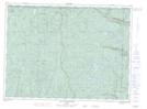
Maps showing Mont Félix-Antoine-Savard, Mont-Élie; Charlevoix-Est, Quebec
Mont Félix-Antoine-Savard is a Mountain located in Mont-Élie; Charlevoix-Est, Quebec.
- Latitude: 47° 53' 30'' North (decimal: 47.8916923)
- Longitude: 70° 29' 59'' West (decimal: -70.4997977)
- Topography Feature Category: Mountain
- Geographical Feature: Mont
- Canadian Province/Territory: Quebec
- Location: Mont-Élie; Charlevoix-Est
- Atlas of Canada Locator Map: Mont Félix-Antoine-Savard
- GPS Coordinate Locator Map: Mont Félix-Antoine-Savard Lat/Long
Mont Félix-Antoine-Savard NTS Map Sheets