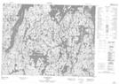
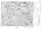
Maps showing Baie aux Sables, Mont-Valin; Le Fjord-du-Saguenay, Quebec
Baie aux Sables is a Bay located in Mont-Valin; Le Fjord-du-Saguenay, Quebec.
- Latitude: 49° 26' 43'' North (decimal: 49.4453184)
- Longitude: 70° 30' 14'' West (decimal: -70.5039653)
- Topography Feature Category: Bay
- Geographical Feature: Baie
- Canadian Province/Territory: Quebec
- Location: Mont-Valin; Le Fjord-du-Saguenay
- Atlas of Canada Locator Map: Baie aux Sables
- GPS Coordinate Locator Map: Baie aux Sables Lat/Long
Baie aux Sables NTS Map Sheets