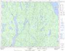
Maps showing Portage Itshitakan, Rivière-aux-Outardes; Manicouagan, Quebec
Portage Itshitakan is a Road feature located in Rivière-aux-Outardes; Manicouagan, Quebec.
- Latitude: 51° 5' 51'' North (decimal: 51.0975)
- Longitude: 69° 18' 42'' West (decimal: -69.3116667)
- Topography Feature Category: Road feature
- Geographical Feature: Portage
- Canadian Province/Territory: Quebec
- Location: Rivière-aux-Outardes; Manicouagan
- Atlas of Canada Locator Map: Portage Itshitakan
- GPS Coordinate Locator Map: Portage Itshitakan Lat/Long
Portage Itshitakan NTS Map Sheets