Maps showing Ruisseau Uapush Ushtikuan, Rivière-aux-Outardes; Manicouagan, Quebec
Ruisseau Uapush Ushtikuan is a River located in Rivière-aux-Outardes; Manicouagan, Quebec.
- Latitude: 50° 37' 30'' North (decimal: 50.6250833)
- Longitude: 69° 17' 27'' West (decimal: -69.2909094)
- Topography Feature Category: River
- Geographical Feature: Ruisseau
- Canadian Province/Territory: Quebec
- Location: Rivière-aux-Outardes; Manicouagan
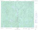
- Atlas of Canada Locator Map: Ruisseau Uapush Ushtikuan
- GPS Coordinate Locator Map: Ruisseau Uapush Ushtikuan Lat/Long
Ruisseau Uapush Ushtikuan NTS Map Sheets