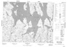
Maps showing Digue Ushkutim, Mont-Valin; Le Fjord-du-Saguenay, Quebec
Digue Ushkutim is a Hydraulic construction located in Mont-Valin; Le Fjord-du-Saguenay, Quebec.
- Latitude: 50° 39' 28'' North (decimal: 50.6578518)
- Longitude: 70° 31' 42'' West (decimal: -70.5284041)
- Topography Feature Category: Hydraulic construction
- Geographical Feature: Digue
- Canadian Province/Territory: Quebec
- Location: Mont-Valin; Le Fjord-du-Saguenay
- GPS Coordinate Locator Map: Digue Ushkutim Lat/Long
Digue Ushkutim NTS Map Sheets