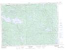
Maps showing Lacs Pearl, Témiscaming; Témiscamingue, Quebec
Lacs Pearl is a Lake located in Témiscaming; Témiscamingue, Quebec and has an elevation of 265 meters.
- Latitude: 46° 33' 12'' North (decimal: 46.5533333)
- Longitude: 78° 50' 50'' West (decimal: -78.8472222)
- Topography Feature Category: Lake
- Geographical Feature: Lacs
- Canadian Province/Territory: Quebec
- Elevation: 265 meters
- Location: Témiscaming; Témiscamingue
- Atlas of Canada Locator Map: Lacs Pearl
- GPS Coordinate Locator Map: Lacs Pearl Lat/Long
Lacs Pearl NTS Map Sheets