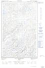
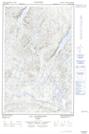
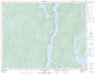
Maps showing Rivière du Repos, Rivière-aux-Outardes; Manicouagan, Quebec
Rivière du Repos is a River located in Rivière-aux-Outardes; Manicouagan, Quebec.
- Latitude: 50° 48' 22'' North (decimal: 50.8061546)
- Longitude: 69° 2' 40'' West (decimal: -69.0444957)
- Topography Feature Category: River
- Geographical Feature: Rivière
- Canadian Province/Territory: Quebec
- Location: Rivière-aux-Outardes; Manicouagan
- Atlas of Canada Locator Map: Rivière du Repos
- GPS Coordinate Locator Map: Rivière du Repos Lat/Long
Rivière du Repos NTS Map Sheets