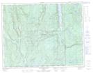
Maps showing Parcours d'Eau, Lac-Walker; Sept-Rivières, Quebec
Parcours d'Eau is a River located in Lac-Walker; Sept-Rivières, Quebec.
- Latitude: 50° 9' 22'' North (decimal: 50.1561508)
- Longitude: 67° 4' 53'' West (decimal: -67.0812907)
- Topography Feature Category: River
- Geographical Feature: Ruisseau
- Canadian Province/Territory: Quebec
- Location: Lac-Walker; Sept-Rivières
- Atlas of Canada Locator Map: Parcours d'Eau
- GPS Coordinate Locator Map: Parcours d'Eau Lat/Long
Parcours d'Eau NTS Map Sheets