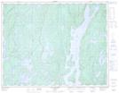
Maps showing Passe Étroite, Rivière-aux-Outardes; Manicouagan, Quebec
Passe Étroite is a Channel located in Rivière-aux-Outardes; Manicouagan, Quebec.
- Latitude: 50° 2' 21'' North (decimal: 50.0391667)
- Longitude: 68° 53' 50'' West (decimal: -68.8972222)
- Topography Feature Category: Channel
- Geographical Feature: Passe
- Canadian Province/Territory: Quebec
- Location: Rivière-aux-Outardes; Manicouagan
- Atlas of Canada Locator Map: Passe Étroite
- GPS Coordinate Locator Map: Passe Étroite Lat/Long
Passe Étroite NTS Map Sheets