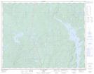
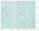
Maps showing Lac L.-H.-L., Rivière-aux-Outardes; Manicouagan, Quebec
Lac L.-H.-L. is a Lake located in Rivière-aux-Outardes; Manicouagan, Quebec.
- Latitude: 50° 29' 37'' North (decimal: 50.4936563)
- Longitude: 68° 51' 54'' West (decimal: -68.8651082)
- Topography Feature Category: Lake
- Geographical Feature: Lac
- Canadian Province/Territory: Quebec
- Location: Rivière-aux-Outardes; Manicouagan
- Atlas of Canada Locator Map: Lac L.-H.-L.
- GPS Coordinate Locator Map: Lac L.-H.-L. Lat/Long
Lac L.-H.-L. NTS Map Sheets