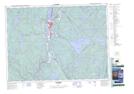
Maps showing Crique Clair, La Tuque; Le Haut-Saint-Maurice, Quebec
Crique Clair is a River located in La Tuque; Le Haut-Saint-Maurice, Quebec.
- Latitude: 47° 16' 35'' North (decimal: 47.2763889)
- Longitude: 72° 51' 15'' West (decimal: -72.8541667)
- Topography Feature Category: River
- Geographical Feature: Ruisseau
- Canadian Province/Territory: Quebec
- Location: La Tuque; Le Haut-Saint-Maurice
- Atlas of Canada Locator Map: Crique Clair
- GPS Coordinate Locator Map: Crique Clair Lat/Long