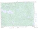
Maps showing Baie Clark, Témiscaming; Témiscamingue, Quebec
Baie Clark is a Bay located in Témiscaming; Témiscamingue, Quebec and has an elevation of 272 meters.
- Latitude: 46° 40' 37'' North (decimal: 46.6769444)
- Longitude: 78° 52' 28'' West (decimal: -78.8744444)
- Topography Feature Category: Bay
- Geographical Feature: Baie
- Canadian Province/Territory: Quebec
- Elevation: 272 meters
- Location: Témiscaming; Témiscamingue
- Atlas of Canada Locator Map: Baie Clark
- GPS Coordinate Locator Map: Baie Clark Lat/Long
Baie Clark NTS Map Sheets