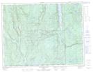
Maps showing Lac Uso, Lac-Walker; Sept-Rivières, Quebec
Lac Uso is a Lake located in Lac-Walker; Sept-Rivières, Quebec.
- Latitude: 50° 3' 6'' North (decimal: 50.0517096)
- Longitude: 67° 15' 41'' West (decimal: -67.2613177)
- Topography Feature Category: Lake
- Geographical Feature: Étang
- Canadian Province/Territory: Quebec
- Location: Lac-Walker; Sept-Rivières
- Atlas of Canada Locator Map: Lac Uso
- GPS Coordinate Locator Map: Lac Uso Lat/Long
Lac Uso NTS Map Sheets