Canada Topographic Maps

Lac Iqalulik Topo Maps

Topography maps and Latitude/Longitude Location

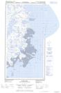
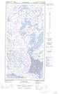
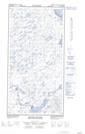
Maps showing Lac Iqalulik, Rivière-Koksoak; Kativik, Quebec

Lac Iqalulik is a Lake located in Rivière-Koksoak; Kativik, Quebec.

  • Latitude: 60° 14' 29'' North   (decimal: 60.2413148)
  • Longitude: 69° 44' 36'' West   (decimal: -69.7433627)
  • Topography Feature Category: Lake
  • Geographical Feature: Lac
  • Canadian Province/Territory: Quebec
  • Location: Rivière-Koksoak; Kativik
  • Atlas of Canada Locator Map: Lac Iqalulik
  • GPS Coordinate Locator Map: Lac Iqalulik Lat/Long

Lac Iqalulik NTS Map Sheets

025C04E Kyak Bay Topographic Map at 1:50,000 scale

025C04W Kyak Bay Topographic Map at 1:50,000 scale

025C05E Plover Islands Topographic Map at 1:50,000 scale

025C05W Plover Islands Topographic Map at 1:50,000 scale

025C Akpatok Island Topographic Map at 1:250,000 scale

 
Buy Topographic Maps DVD
Newsletter Sign-up

Yes, I want to receive map store discounts.


Bookmark and Share