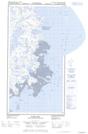
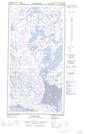
Maps showing Langue de terre Qulluviup, Rivière-Koksoak; Kativik, Quebec
Langue de terre Qulluviup is a Cape located in Rivière-Koksoak; Kativik, Quebec.
- Latitude: 60° 8' 12'' North (decimal: 60.1365973)
- Longitude: 69° 35' 27'' West (decimal: -69.5908709)
- Topography Feature Category: Cape
- Geographical Feature: Langue de terre
- Canadian Province/Territory: Quebec
- Location: Rivière-Koksoak; Kativik
- Atlas of Canada Locator Map: Langue de terre Qulluviup
- GPS Coordinate Locator Map: Langue de terre Qulluviup Lat/Long
Langue de terre Qulluviup NTS Map Sheets