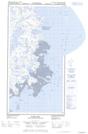
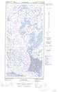
Maps showing Dunes Siurajaaraaluk, Kangirsuk; Kativik, Quebec
Dunes Siurajaaraaluk is a Mountain located in Kangirsuk; Kativik, Quebec.
- Latitude: 60° 1' 24'' North (decimal: 60.0232675)
- Longitude: 69° 55' 50'' West (decimal: -69.9306174)
- Topography Feature Category: Mountain
- Geographical Feature: Dunes
- Canadian Province/Territory: Quebec
- Location: Kangirsuk; Kativik
- Atlas of Canada Locator Map: Dunes Siurajaaraaluk
- GPS Coordinate Locator Map: Dunes Siurajaaraaluk Lat/Long
Dunes Siurajaaraaluk NTS Map Sheets